Friday, June 10, 2011

Utah Open Lands Property: Green Ravine, Oquirrh Mountains, UT. 6/2/2011


An ancient sea cliff on the left, looking over what's left of the once 1,000 foot deep lake.


A view along the property line.


This is where I was when we spoke Erica :)


Check out the tilt of the Stansbury Mountains in the background, it's not the result of an un-leveled camera. 


Fantastic down-warping seen through the cut in the ridge. 


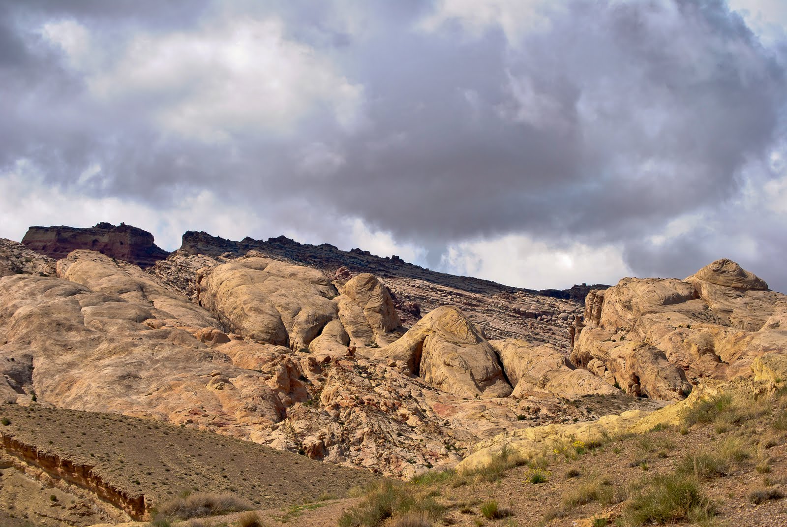
What I found visually interesting in this shot was the 45 degree dip in the bedrock of the foreground. Yet, father east in the top left of the picture, the bedrock that's been exposed seems as though the layers were neatly stacked; which they were, but never tilted by tectonics.


I get college credit and professional experience for this? I think i chose wisely.


Utah Open Lands Property: University of Utah Heritage Preserve, Shoreline Trail, UT. 5/28-6/1/2011


The highpoint of one of the lower westerly ridges.


A couple of shorelines from ancient lakes are visible in the center of the picture. Look at the large vertical surface in the center: you can see the Bonneville shoreline at the top and a Provo shoreline on the bottom.


Utah Open Lands Property: Castleton Tower, Castle Valley, UT. 5/22/2011


Castleton Tower, the result of differential erosion along what was formerly a large plateau.


An interesting monocline with the La Sals in the background.

Friday, June 3, 2011

Backpacking N.E. of Moab, UT. 5/20-24/2011


Our humble home on the trail. 


Look at all that awesome cross-bedding on those petrified sand dunes. 


The girl who kicked my ass hiking and humbled me on this trip.


Desert thunderstorms blowing in.

San Rafael Swell, UT. 05/19/2011


 ~30 miles S.W. of Green River, UT.